
Stage 6. FROM LEINTWARDINE TO KNIGHTON

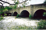
PLAN YOUR ROUTE There are six road bridges between Leintwardine and Knighton. The major roads follow the valley floor. For more details use O.S. Explorers Maps 203 and 201.
The Heart of Wales railway runs through the valley to the north of the river.
EXPLORING THIS AREA
Looking at the young river when it flows quietly out through the gap in the hills at Knighton and along the flat valley floor due east towards Leintwardine it is difficult to imagine the effect these waters can have on the flood plain of the Severn Vale near Worcester.
Earthworks are reminders of past civilisations. Before the Romans came Celtic Iron Age tribes lived in farmsteads and small settlements protected by the hillforts. As the Romans moved north and west in their conquest of Britain they established their base at Wroxeter, overcame the resistance of the British chieftain Caractacus and then tightened their grip on the land around here where tribes to the west were particularly troublesome. Once they had a stable boundary they policed it. Marching camps at Brampton Bryan and Buckton, forts at Walford and Jay Lane and Leintwardine indicate a significant Roman presence. Leintwardine fort covered 11 acres and garrisoned up to 500 troops. They policed the movement of traffic along Watling Street. In Saxon times the river crossing was the site of the changing of the guard – the Shropshire guard handed over to Herefordshire the responsibility for protecting kings as they travelled around.
Before leaving Leintwardine visit the church where the chancel was built over the Roman vallum (defensive rampart). The Mortimers were patrons of this church. Today the churchyard is being managed for wildlife, look for mistletoe in an oak tree!
Explore the Roman road that strikes off the the A4110 towards Paytoe and go south to Brandon Camp where archaeologists have discovered a Roman granary and courtyard house.
With their neighbours the Mortimers, the Bramptons were present at the foundation of Wigmore Abbey. The last of the Bramptons married a Harley, in 1308. Harleys still live in Brampton Bryan. Visit the church to see a double hammer beam roof that came from the ruined castle when the church was rebuilt after the Civil War. When war broke Sir Robert Harley, a Parliamentarian and iconoclast, was in London. A remarkable series of letters written by Lady Brilliana, his wife, to her son tells the story of how she held out when the castle and the whole area was besieged by Royalist troops.
Across the river is Croxall Knoll. Was it here that Caractacus was finally defeated by the Romans? Pause a while down by the river at Lingen Bridge, listen to the birds. Kingfishers, grey wagtail and dippers, even otters, can all be seen around here. Not many grayling and trout will be found this far up the river but try to spot a grayling - the queen of fish. Its body is silvery blue with a green tint along the back and a tinge of red in the fins. Visiting Bucknell church with its Saxon font, pick up a trail leaflet. Drive on to Stowe, approach along the narrow road out of Bucknell or go back across Lingen Bridge. On the A4113 cross the border: the road on this side of the river is in Wales, over the river it’s still Shropshire, England! There is a hotel with gardens that go down to the river. The tiny church at Stowe was mother church to the church in Knighton, medieval house platforms in the field immediately to the south of the church indicate a much larger settlement. Walkers can follow the medieval track to Knighton.
CHURCHES TO VISIT
St Barnabas, Brampton Bryan.
St. Mary, Bucknell.
St Mary Magdalene, Leintwardine.
St. Michael, Stowe.
AROUND & ABOUT
1. Wigmore Castle and church
2. Shobdon Church and rches.
3. Caer Caradoc, the hill fort near Chapel Lawn. O.S. 201:368669.
4. The Judges Lodgings at Presteigne.
5. The Secret Hills Discovery Centre at Craven Arms.
6. Offa's Dyke Centre in Kington.
7. Lingen Church, nurseries and gardens.
WALK
Walk the Mortimer Trail
Local walking; O.S. Explorer Maps Nos 201 & 203.
Long Distance: A teme Valley Walk - a route devised by david Milton ISBN 1-869922-45-x
MORE INFORMATION
Trains - Heart of Wales Line. 08457 484950
Ludlow Tourist Information cCentre. www.ludlow.org.uk/ BR The Mortimer Consortium. www.mortimercountry.co.uk/
Offa's Dyke Centre www.offasdyke.demon.co.uk/